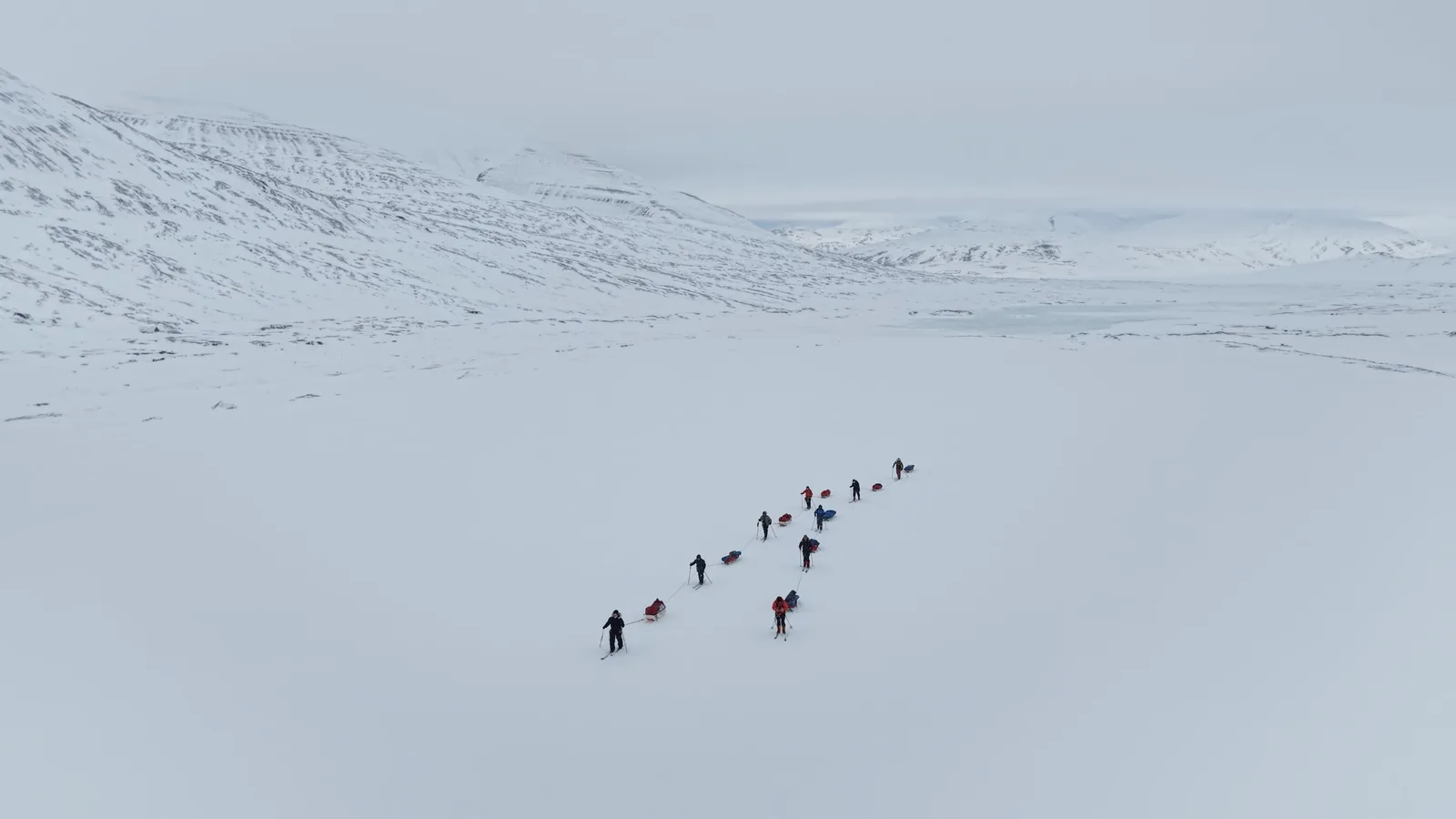
I was on Svalbard from March 29 to April 6, 2026, on a PolarExplorers ski and pulk expedition. Six days on the ice and five nights in a tent, up Adventdalen, over a glaciated pass and back around through the valleys behind it. The trip itself, and what the guides said at the debrief, is in Pulking in Svalbard.
I wanted aerial footage, and the flying was the part I prepared for. Three or four practice flights in the United States, one in England, and a test run up the valley once I got to Svalbard. The paperwork was the part I underestimated. Three separate registrations across two government agencies, a national login system built for people who have a Norwegian personal number, and a working knowledge of where you are standing to within a few hundred meters.
The three registrations
Norway's drone rules come from the Civil Aviation Authority and apply on Svalbard the same as on the mainland, with a stack of Svalbard-specific bans layered on top. There are three things to do before you fly, and they are not bundled together anywhere obvious.
First, operator registration at flydrone.no. You register as an operator, you are issued an operator number, and you mark that number on the airframe. I did mine with a Sharpie and a bit of sticky tape, writing the number on the tape and then sticking the tape to the drone so it would not come off. It is quite a long number, so I had to write quite small. It costs NOK 230 a year, call it about twenty-two dollars. My DJI Mini 5 Pro needs it because it has a camera. The exemption people quote for drones under 250 grams only applies to a drone without one, which means almost nothing anyone actually wants to fly qualifies.
Second, the A1/A3 certificate of competence, a free online course and exam on the same portal. Plenty of guides describe this as compulsory and it is not, at least not for what I was flying. A C0-class drone under 250 grams does not require it. The CAA's own requirements table lists the user manual as the only thing you have to have read. But the course is free, it takes about an hour, and it becomes mandatory the moment you fly anything heavier than the Mini class. I did it anyway.
Third, and this is the one almost nobody mentions, sensor registration with NSM, Norway's National Security Authority, at registrering.sensor.nsm.cloudgis.no. If you are flying with a camera anywhere in Norway, you register the sensor. The registration is a map. You mark out the area you plan to fly and the days you plan to fly it, and each area is capped, at five thousand square kilometers as I remember it. Separate agency, separate portal, separate form from anything on flydrone.no. Nothing on the aviation side prompts you toward it, which is how most people miss it.
Do them in that order. Operator registration is the one with a fee and the one that can stall, so it is the one to start first.
Your American license is worth nothing here
If you hold an FAA Part 107 or a TRUST certificate, Norway does not care. Neither is accepted. A registration from an EASA state is accepted, which is useful if you live in Europe and no help at all if you do not.
The real obstacle is smaller and more irritating than the rules themselves. Login to flydrone.no runs through ID-porten, Norway's national identity gateway, which is built around a Norwegian personal number and a Norwegian bank ID. On a US passport you have neither. Getting my license through took a few rounds of email with the authority. They were relaxed and helpful about the whole thing and it got sorted, but it is not a form you fill in once and forget about.
So budget an afternoon plus contingency. I had assumed it would take a month, and it did not come close. Start early anyway, because the failure mode is arriving on Svalbard with a drone you are not allowed to switch on.
The whole of Longyearbyen is a no-fly zone
Svalbard Airport Longyear sits about five kilometers northwest of town, and there is a five kilometer prohibited zone around it. The Governor states the consequence plainly, that "the whole of Longyearbyen is therefore within the prohibited zone." Only the airport control tower can lift it. The Governor cannot, which catches people out, since the Governor is the police authority on the archipelago and the obvious person to ask.
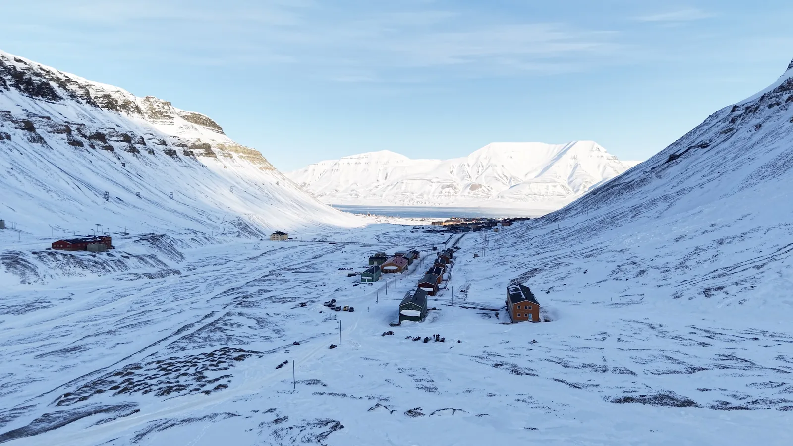
I was staying at the Coal Miners' Cabins in Nybyen, at the top of Longyeardalen, and before I flew I took the official drone map and overlaid it on Google Maps. The boundary crosses the valley a few hundred meters above the cabins, almost exactly where the official road ends at the polar bear sign. The cabins themselves sit about 130 meters inside the line.
Past that sign you are out of the no-drone zone, and you are also outside the settlement, which puts you in the space where the bear rules apply and you need to be carrying something to scare one off. The Governor publishes the drone map on ArcGIS, linked from the Svalbard drone page. Overlay it and check your own position.
Two thirds of the archipelago is closed to you, permanently
Drones are banned outright in every protected area on Svalbard. Seven national parks and twenty-one nature reserves, about sixty-five percent of the land area. There is no application to make, because the regulations only permit drone use "for purposes other than recreational and hobby activities." A hobbyist is excluded by definition.
Then a set of rules that bite outside the parks as well. A statutory five hundred meter exclusion around bird cliffs from April 1 to August 31, which came into force partway through my own trip. A three hundred meter minimum distance from polar bears, rising to five hundred meters from March 1 to June 30, which covers most of the season anyone would want to be out there on skis. And a one hundred meter security zone around cultural heritage predating 1946, which on Svalbard means the abandoned mine structures and cableway towers that are some of the most photogenic things in the valley.
That last one is easy to trip over, because protected mining infrastructure around Longyearbyen does not always come with a sign and a fence. The hundred meters applies either way. If the interesting thing in your frame is old and industrial, work out how old before you take off.
Where I flew, and how close I came
My test flights were up the valley above Nybyen, outside the airport zone, looking back down toward the town. There are old coal mining buildings up there and the ground gives you a decent line down the valley. I flew there deliberately, before the expedition started, to find out how the aircraft behaved in the cold somewhere I could walk home from.
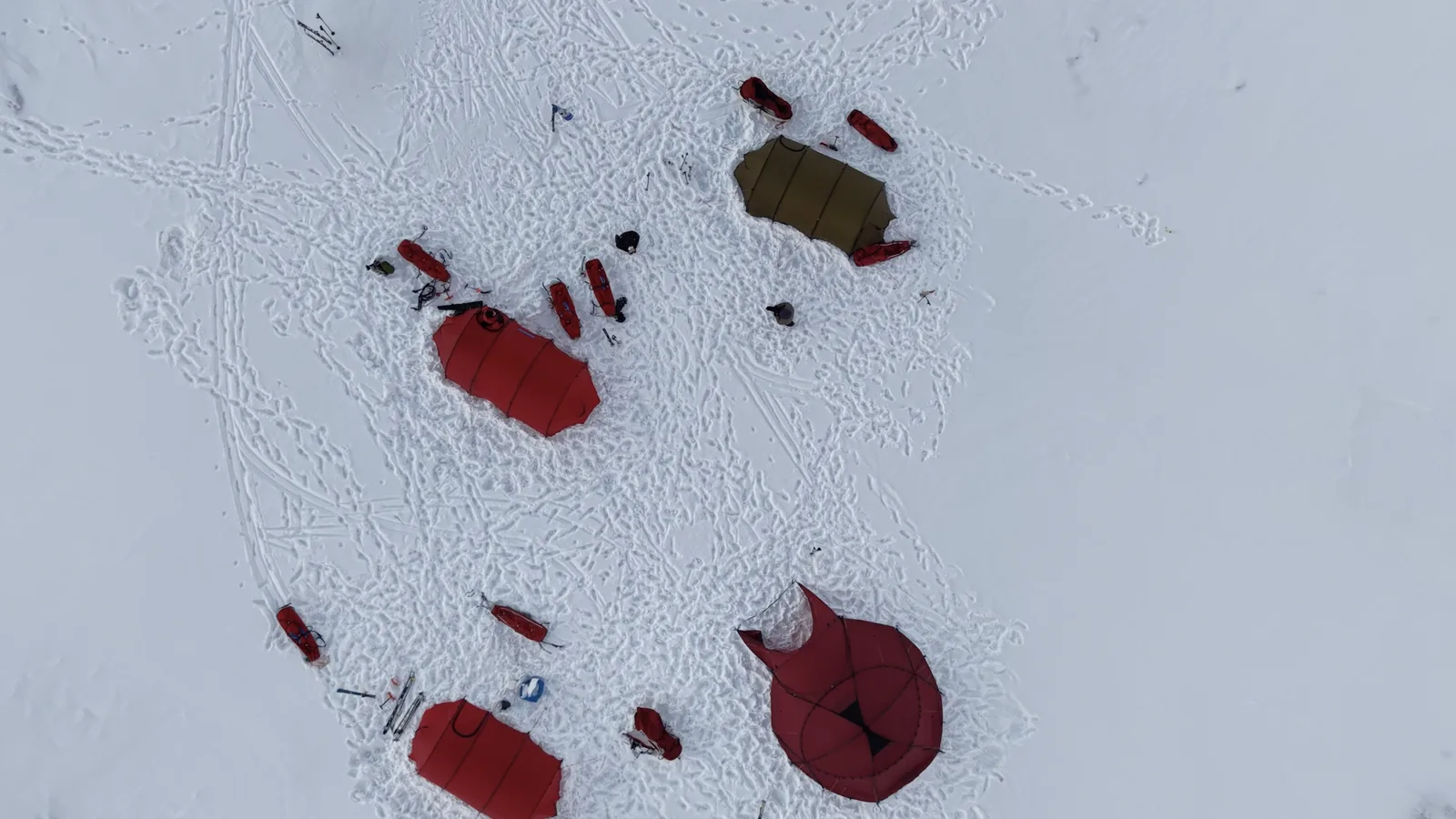
The flight I care about was at the camp on the glacier, on Plogbreen, just over Foxpasset. That site is outside Van Mijenfjorden National Park by about 1.3 kilometers, so the flight was legal. The margin was that thin, and I did not know it at the time. I worked it out afterward, at a desk, with the park boundary polygon on a map, which is the wrong order to do it in.
The following night we camped down in Tverrdalen, and that camp was inside the park. There is no plausible position for a Tverrdalen camp that is not. Same trip, same week, one valley along, and the status flips from legal to banned outright with no hobbyist exemption available.
Enforcement is real
It would be easy to assume the rules go quietly unenforced on an archipelago of about 2,900 people. In May 2026 two visitors were fined for flying over central Longyearbyen, NOK 8,000 for one and NOK 12,000 for the other, call it roughly 800 and 1,200 dollars, and the second had the drone confiscated.
Flying in the cold
I flew a DJI Mini 5 Pro, chosen deliberately to sit under 250 grams, and carried two spare YATEOO 5000 mAh flight batteries. The weight class keeps you out of the heavier regulatory tier, and it keeps the whole camera setup light enough to justify its place in a pulk you are dragging for six days. It also has obstacle sensing and subject tracking, which matters when nobody else on the trip is going to hold the controller.
The batteries performed remarkably well, and I had been nervous about them. It was minus twenty most of the time I flew. My routine was to warm each battery against my body first, then get it into the drone and get airborne quickly. The longest flight was twenty-eight minutes, hovering over the campsite while we built it, and the drone came down beeping and trying to return to home. I was only comfortable keeping it up that long because it was directly above us, so if the battery gave out it was going to land more or less on me. Away from camp I never pushed past about fifteen minutes, because a dead battery at distance means a lost drone. It never came close to happening.
The drone's batteries are also only half of it. The controller has one too, and that turned out to be the easy half, since one charge of the controller covered flying all five flight batteries.
Condensation never became a problem. The Arctic at those temperatures is very dry, dry tundra is the phrase, and while a tent full of breathing people generates its own moisture, the drone never picked any of it up.
Hands on the controller were a real issue. I flew in my working gloves, the same pair that is on the kit list, and I had practiced flying in them a number of times back in the United States. The routine was mittens off, lift the controller out from inside my inner layer where it rode warm, and fly. The thing I wish I had carried was a lanyard, so the controller could sit against my body between flights instead of being fished out of my clothing. I have invested in one since, ready for the next trip.
Minus twenty was roughly what I flew in, a little colder in the evenings and a little warmer in daytime sun. The drone never threw a cold weather warning. What it did throw, a couple of times, was a broken blade warning when no blades were broken.
The one real incident was a crash into snow. The drone came down, its own heat melted the snow around it, and the meltwater got inside and refroze, so by the time I found it there was ice frozen inside the motors at the ends of the arms. I knocked out the ice, warmed the drone gently in the tent that evening, and it has performed fine ever since I got back.
Everything lived in a camera bag during the day, the drone, the cards, the spare batteries, and the controller. A flight had to be planned about an hour ahead, because that is when a battery and the controller went inside my clothing to start warming. The drone itself stayed in the bag until the last minute, then out, assembled quickly, and airborne as fast as I could manage.
Check this yourself
Svalbard's field operation rules changed on January 1, 2026, and the drone requirements sit inside a regulatory stack that gets revised regularly. Read the primary sources rather than taking a traveler's word for it, mine included. Four are worth bookmarking. flydrone.no handles operator registration and the competence exam. The CAA's own guide sits at luftfartstilsynet.no, the Governor's Svalbard-specific rules and drone map at sysselmesteren.no, and NSM sensor registration at registrering.sensor.nsm.cloudgis.no.
I would put it at maybe seventy percent that some part of this tightens again in the next couple of years, given how fast the field rules moved this year. Nothing secondhand is a substitute for checking the week you go.
Forty minutes
The flight I wanted most was over the glacier camp on Plogbreen, the evening we came over the pass and the cloud broke. It was the most stunning environment I have ever been in, and I flew for forty minutes in the best light I have ever had. Going through the card later, there was nothing on it. I had never pressed record.
Check that the timecode is running. Then enjoy the view.